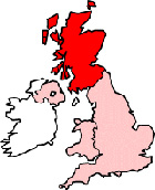
Map of Livingston Scotland and Surrounding Areas
Detailed street map of Livingston town centre and the surrounding areas, towns & villages.
 |
||
Livingston Map Scotland Showing the Town and its Surroundings
Street Map of the Scottish Town of Livingston: Find places of interest in the town of Livingston in West Lothian, Scotland UK, with this handy printable street map. View streets in the centre of Livingston and areas which surround Livingston, including neighbouring villages and attractions. Large Livingston map.
Places of interest in and surrounding Livingston, West Lothian include: Toronto Primary School, Uphall Station, Deans, Almond Park, Deer Park Country Club, Howden Park, Deer Park Golf Course, Howden Park Centre, Inveralmond Community High School, The Bistro Restaurant, Dechmont Moss Wood, Pumpherston, St John's Hospital Livingston, St Andrews Catholic Church, The A705 (Cousland Road), St Peters RC Church, Craigshill High School Playing Field, The River Almond, The A899 (Livingston Road), Almondvale, Livingston Free Church, Livingston Parish Church, Livingston Baptist Church, Newyearfield Wood, The D Luxe Hotel, Livingston Village, Knightsridge Primary School, Peel Park, Houstown Industrial Estate, Carmondean, Livingston North Railway Station (Train Station), Houstown Wood, Oscar's Bar & Grill, Livingston Station, Premier Inn Livingston, Harrysmuir After School Club and more.
Highlights of This Livingston West Lothian Map:
- Easy to Print Map for Town Centre of Livingston.
- Get a Satellite View of Livingston.
- Find Routes To and From Livingston area.
- View Villages and Towns Around Livingston.
- Identify Livingston Areas of Interest.
- See Livingston Housing & Industrial Estates.
- Easily Find Livingston Tourist Attractions.
- Zoom in, Pan and Move Around Livingston.
- See Rivers, Canals, Lakes and Waterways.
The Post Code for Livingston is: EH53
Locate streets and roads in and near Livingston, locate interesting places and attractions in and near Livingston, locate churches and religious centres in and near Livingston, locate hospitals and health centres in and near Livingston, locate towns and villages surrounding Livingston area.
More Maps of Scotland:
- Map of Kinross Area & Surroundings
- Map of Saltcoats Area & Surroundings
- Map of Lanark Area & Surroundings
- Map of Cumnock Area & Surroundings
- Map of Larbert Area & Surroundings
England Town Maps - Spanish Town Maps - Hampshire Town Maps