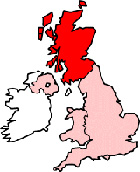
Map of Lerwick Scotland and Surrounding Areas
Detailed street map of Lerwick town centre and the surrounding areas, towns & villages.
 |
||
Lerwick Map Scotland Showing the Town and its Surroundings
Street Map of the Scottish Town of Lerwick: Find places of interest in the town of Lerwick in Shetlands, Scotland UK, with this handy printable street map. View streets in the centre of Lerwick and areas which surround Lerwick, including neighbouring villages and attractions. Large Lerwick map.
Places of interest in and surrounding Lerwick, Shetlands include: Lerwick Ferry Terminal, Shetland Library, The A970, The Shetland Museum & Archives, Lerwick Visitor Information Centre, Glen Orchy Guest House, Sound, Gibertson Park, Clickimin Loch, The Grand Hotel, HIE Shetland, The A969, CLickimin Leisure Complex, Lerwick Youth Hostel, Market Street Lerwick, The Lerwick Hotel, Holmsgarth, Anderson High School, St Margarets RC Church, Sheriff Clerks Office, Shetland Islands Council Offices and more.
Highlights of This Lerwick Shetlands Map:
- Easy to Print Map for Town Centre of Lerwick.
- Get a Satellite View of Lerwick.
- Find Routes To and From Lerwick area.
- View Villages and Towns Around Lerwick.
- Identify Lerwick Areas of Interest.
- See Lerwick Housing & Industrial Estates.
- Easily Find Lerwick Tourist Attractions.
- Zoom in, Pan and Move Around Lerwick.
- See Rivers, Canals, Lakes and Waterways.
The Post Code for Lerwick is: ZE1
Locate streets and roads in and near Lerwick, locate interesting places and attractions in and near Lerwick, locate churches and religious centres in and near Lerwick, locate hospitals and health centres in and near Lerwick, locate towns and villages surrounding Lerwick area.
More Maps of Scotland:
- Map of Lenzie Area & Surroundings
- Map of Ballingry Area & Surroundings
- Map of Linwood Area & Surroundings
- Map of Aberdeen Area & Surroundings
- Map of Lochgelly Area & Surroundings
England Town Maps - Spanish Town Maps - Hampshire Town Maps