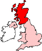
Map of Kirkwall Scotland and Surrounding Areas
Detailed street map of Kirkwall town centre and the surrounding areas, towns & villages.
 |
||
Kirkwall Map Scotland Showing the Town and its Surroundings
Street Map of the Scottish Town of Kirkwall: Find places of interest in the town of Kirkwall in Orkney, Scotland UK, with this handy printable street map. View streets in the centre of Kirkwall and areas which surround Kirkwall, including neighbouring villages and attractions. Large Kirkwall map.
Places of interest in and surrounding Kirkwall, Orkney include: Centre for Nordic Studies, Orkney Library & Archive, St Magnus Cathedral, The Orkney Museum, Bignold Park, The Albert Hotel, Peedie Sea, Orkney College, Kirkwall High Street, Tankerness House, Kirkwall Ferry Terminal, The A965, Fusion Bar, St Olaf's Cemetery, Kirkwall Baptist Church, Pomona Cafe, Orkney Wireless Museum, St Ola, Model Yacht Lake, The A960, The Auld Motor Hoose Pub, Kirkwall Visitor Information Centre, St Olaf Church and more.
Highlights of This Kirkwall Orkney Map:
- Easy to Print Map for Town Centre of Kirkwall.
- Get a Satellite View of Kirkwall.
- Find Routes To and From Kirkwall area.
- View Villages and Towns Around Kirkwall.
- Identify Kirkwall Areas of Interest.
- See Kirkwall Housing & Industrial Estates.
- Easily Find Kirkwall Tourist Attractions.
- Zoom in, Pan and Move Around Kirkwall.
- See Rivers, Canals, Lakes and Waterways.
The Post Code for Kirkwall is: KW15
Locate streets and roads in and near Kirkwall, locate interesting places and attractions in and near Kirkwall, locate churches and religious centres in and near Kirkwall, locate hospitals and health centres in and near Kirkwall, locate towns and villages surrounding Kirkwall area.
More Maps of Scotland:
- Map of Beith Area & Surroundings
- Map of Motherwell Area & Surroundings
- Map of Haddington Area & Surroundings
- Map of Loanhead Area & Surroundings
- Map of Blairgowrie Area & Surroundings
England Town Maps - Spanish Town Maps - Hampshire Town Maps