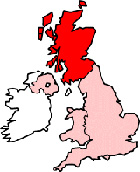
Map of Dunfermline Scotland and Surrounding Areas
Detailed street map of Dunfermline town centre and the surrounding areas, towns & villages.
 |
||
Dunfermline Map Scotland Showing the Town and its Surroundings
Street Map of the Scottish Town of Dunfermline: Find places of interest in the town of Dunfermline in Fife, Scotland UK, with this handy printable street map. View streets in the centre of Dunfermline and areas which surround Dunfermline, including neighbouring villages and attractions. Large Dunfermline map.
Places of interest in and surrounding Dunfermline, Fife include: Headwell, St Leonard's Parish Church, Sinclair Gardens, Town Loch, Grill 48 Restaurant, Pittencrieff Park, The Grange Centre, Kingsgate Shopping Centre, Lyne Burn, Rumblingwell, Dunfermline High St, Pittencrief Primary School, McKane Park, Viewfield Baptist Church, Fife Fire & Rescue, Andrew Carnegie Birthplace Museum, Dunfermline Train Station (Dunfermline Town), Tower Burn, Abbot House Heritage Centre, Rex Park, The Old Inn Pub, Queen Margaret Hospital, Johnsons Amusement Arcade, East End Park, Dunfermline Police Station, The A823, Dunfermline Palace, East Port Bar, Dunfermline Cemetery, The A907, Wellwood, Dunfermline Queen Margaret Railway Station, Liberty Church, Nethertown Surgery, Dunfermline Carnegie Library, Dunfermline Station, Carnegie Drive Retail Park and more.
Highlights of This Dunfermline Fife Map:
- Easy to Print Map for Town Centre of Dunfermline.
- Get a Satellite View of Dunfermline.
- Find Routes To and From Dunfermline area.
- View Villages and Towns Around Dunfermline.
- Identify Dunfermline Areas of Interest.
- See Dunfermline Housing & Industrial Estates.
- Easily Find Dunfermline Tourist Attractions.
- Zoom in, Pan and Move Around Dunfermline.
- See Rivers, Canals, Lakes and Waterways.
The Post Code for Dunfermline is: KY11
Locate streets and roads in and near Dunfermline, locate interesting places and attractions in and near Dunfermline, locate churches and religious centres in and near Dunfermline, locate hospitals and health centres in and near Dunfermline, locate towns and villages surrounding Dunfermline area.
More Maps of Scotland:
- Map of Cumbernauld Area & Surroundings
- Map of Carluke Area & Surroundings
- Map of Prestonpans Area & Surroundings
- Map of Leven Area & Surroundings
- Map of Bonnyrigg Area & Surroundings
England Town Maps - Spanish Town Maps - Hampshire Town Maps