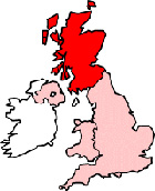
Map of Burntisland Scotland and Surrounding Areas
Detailed street map of Burntisland town centre and the surrounding areas, towns & villages.
 |
||
Burntisland Map Scotland Showing the Town and its Surroundings
Street Map of the Scottish Town of Burntisland: Find places of interest in the town of Burntisland in Fife, Scotland UK, with this handy printable street map. View streets in the centre of Burntisland and areas which surround Burntisland, including neighbouring villages and attractions. Large Burntisland map.
Places of interest in and surrounding Burntisland, Fife include: Burntisland Station, Beacon Leisure Centre, Burntisland Library, The Museum of Communication, The Outer Harbour, The Crown Tavern, Humbie Wood, Burntisland Railway Station (Train Station), Burntisland Golf Club, Stenhouse Reservoir, The Star Pub, Burntisland Post Office, The Beach House B&B, Burntisland Sands Hotel, Pirniss Wood, Kinghorn, The A909, St Josephs RC Church, The A921, The Links, Kinghorn Loch, Burntisland Vets, Burntisland Medical Centre, Burntisland High Street and more.
Highlights of This Burntisland Fife Map:
- Easy to Print Map for Town Centre of Burntisland.
- Get a Satellite View of Burntisland.
- Find Routes To and From Burntisland area.
- View Villages and Towns Around Burntisland.
- Identify Burntisland Areas of Interest.
- See Burntisland Housing & Industrial Estates.
- Easily Find Burntisland Tourist Attractions.
- Zoom in, Pan and Move Around Burntisland.
- See Rivers, Canals, Lakes and Waterways.
The Post Code for Burntisland is: KY3
Locate streets and roads in and near Burntisland, locate interesting places and attractions in and near Burntisland, locate churches and religious centres in and near Burntisland, locate hospitals and health centres in and near Burntisland, locate towns and villages surrounding Burntisland area.
More Maps of Scotland:
- Map of Hamilton Area & Surroundings
- Map of Kirriemuir Area & Surroundings
- Map of Alva Area & Surroundings
- Map of East Kilbride Area & Surroundings
- Map of Stonehaven Area & Surroundings
England Town Maps - Spanish Town Maps - Hampshire Town Maps